3DEP lidar
The USGS 3D Elevation Program's public lidar point clouds and the bare-earth digital elevation models derived from them, covering the United States at 1 m where lidar has been flown.
Facts
- Product
- Classified lidar point clouds (LAZ) and 1 m bare-earth DEM by project; 1/3 arc-second seamless DEM nationwide
- Resolution
- 1 m DEM where lidar exists (finer in some projects); 10 m seamless
- Cadence
- Project by project; no fixed revisit
- Latency
- Months to years from acquisition to publication, by project
- Format
- GeoTIFF (DEM), LAZ (points), Entwine Point Tiles on AWS
- License
- Public domain (US government work)
- Access
- The National Map downloader; AWS Open Data bucket usgs-lidar-public (EPT); py3dep
Load it
import py3dep
import rioxarray  # registers the .rio accessor on xarray objects

# Bounding box in WGS84: (west, south, east, north). Engineer Mountain, CO.
bbox = (-107.83, 37.68, -107.76, 37.73)

# 1 m where a lidar project covers the box; use 10 for the seamless DEM.
dem = py3dep.get_dem(bbox, resolution=1, crs="EPSG:4326")
dem = dem.rio.reproject("EPSG:26913")  # UTM zone 13N, meters
dem.rio.to_raster("dem_3dep.tif")
Where it was wrong on the ground
- The bare-earth DEM removes the trees, so a viewshed from a summit near treeline over-reports what a camera sees below the ridgelines. A 3DEP viewshed from Engineer Mountain: the named summits the model rates in view
- The 1/3 arc-second grid puts the summit 8 m below the 1 m lidar crest, and a viewshed started from the gazetteer coordinate, 20 m off the crest, saw nothing to the north; the observer has to stand on the highest 1 m cell. A 3DEP viewshed from Engineer Mountain: the named summits the model rates in view
Posts using this dataset
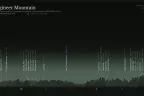
A 3DEP viewshed from Engineer Mountain: the named summits the model rates in view
The 3DEP model rates 27 of 40 named summits above 3,600 m in view from the summit, the farthest Uncompahgre Peak at 51 km; I check the list on my next visit.
· Mountains

Jesse Sprague. Field-checked analyses of public wildfire data. Work: Echospectra.